Thursday, August 2, 2007

Plitvice Lakes Croatian National Park

Plitvice lakes

Plitvice Lakes are one of the most beautiful natural sights in Europe. In the year 1979 UNESCO has declared it with all rights as the World's natural inheritance. National Park Plitvice Lakes with total surface area of 266 km2 comprises 16 terrace-formed lakes, which are mutually connected with waterfalls and cascades. First lake lies on 636 meter altitude, while the last one, 8 km further to the South lies on 133 meters. Largest depth of the lakes is 46 meters, and natural phenomenon of Plitvice is transparency of lake water, which reaches 8 meter deep.
The Lakes are divided into two groups: Upper Lakes (12) surrounded by a huge forest are larger and more quiet while the Lower Lakes (4) lie under 70 meter high cliffs, and are surrounded by low vegetation. Plitvice Lakes were pronounced a National Park in 1949. For its beauty they are talked of as one of the most beautiful natural sights in Europe. In the year 1979 UNESCO has declared it with all rights as the World's natural inheritance. Today Plitvice are the most visited Croatian tourist destination, and the number of guests exceeds even town of Dubrovnik.
The Lakes are situated in the area where flat Croatia enters karst mountain area, and where traffic directions from the North lower towards the coastal areas of Croatia. For this reason Plitvice Lakes are an excellent place for a rest and stop on the way to sea, good lunch or even overnight stay. Distance from Zagreb is 140 km in direction of South.
Plitvice Lakes offer their visitors kilometers of arranged walking paths which in most cases means wooden bridges built over lake surface and serpentine-like connecting one shore to the other.
Since forest vegetation in warmer part of the year is extremely lush due to influence of coastal climate, and continental geographic position supplies Plitvice with plenty of snow in the winter, the National Park is well visited in all seasons of a year. Lakes There are forest areas within the Park, which, due to their virgin wood features, were proclaimed to be special reservates (e.g. Corkova uvala). There is snow on Plitvice from November to March, which is favorable for lovers of cross-country skiing. The Lakes surfaces freeze in December and January.
In the summer water temperature in the largest Lakes, Proscansko and Kozjak is around 24°C, which makes it suitable for bathing. There are altogether 20 caves in to rocks near the Lakes the famous of which are Golubinjača (Pidgeon cave), Mračnjača (Dark cave), Velika pećina (Great cave) and Šupljara (Empty cave).
You can make a tour with a tourist train and boat beside walking. Depending on your choice of visit program (there are six itineraries offered by the management of the National Park), you will need 3 to 6 hours for an organized tour. Guests who wish to stay on Plitvice can find accommodation in hotels Jezero, Plitvice, and Bellevue which are situated in narrow zone of National Park. The accommodation can, beside in hotels, also be found in private houses.
Plitvice Lakes are best known for its legendary film Winnetou based on classic work by Carl May. Original title of the film from 1960-ies, "Treasure of Silver Lake" (Der Schatz im Silbersee) is filmed on Plitvice Lakes starring actors such as Lex Barker, Herbert Lom and Pierre Brice.

Kornati islands Croatia

Should you ever decide to visit the Kornati islands, you may at first be stunned by the contrast of sharp white rocks and the calming blueness of the sea, which hides endless secrets of its inhabitants. However once you became familiar with this natural phenomenon, you would realize that what you are dealing with is a fantastic example of two extremes complementing each other. The coming together of these extremities has created this Croatian national park and will take your breath away.


Kornati Croatian islands

This is how journalist Jon Bowermaster of National Geographic Adventure, embarked on a journey by kayak from Zadar to Dubrovnik and was amazed by the Kornati islands: “the beauty is ragged and rough, cultivated but untamed”. What was it that impressed him so much? Perhaps it was the famous Kornati “crowns” that are the most well known phenomenon of the park.

The “crowns” refer to the beautiful white vertical cliffs that face the open sea. They are witness to, but also the best result of, a long geological process that patiently and carefully shaped them.

The common shag, the gray hawk and the common swift are only some of the inhabitants that have made the crowns their home. You can enjoy the crowns from afar because climbing is not permitted here. Naturally, the crowns stretch under the sea as well which opens up an entirely new dimension to bear witness to if you happen to be a deep-sea diver.

Seven diving zones invite you to discover the underwater thrill. All you have to do is follow the lead of one of the local diving centers that are sure to point you in the right direction. For those of you that are not into diving, the Kornati elevated lookout points are definitely the alternative so head towards Metlina, Opat, Vrujsko, Litnji vrh or Otocevac and you will surely enjoy the view of the entire region of the national park.

Due to the fact that the terrestrial part of the park is privately owned by the inhabitants of the surrounding islands, climbing up any of the peaks requires one to be careful and considerate, which also applies to strolling on the islands. You are probably wondering if people ever lived on the Kornati islands. Take a look at the Illyrian ruins and tumulus, the oldest structures on the islands, situated on high ground on the islands of Kornat and Zut. As a pledge of the Byzantine period we are left with Turet, a fortress on the island of Korant, believed to have been built in the 6th century. Its purpose was to protect and follow ships sailing in what was then the uncertain Adriatic Sea.

A visit to the Solana in Lavsa could also prove to be interesting, in other words its sunken remains, but also a small island called Vela Panitula, where the Venetian fortalice was built during the beginning of the 16th century. It was in this fortalice that Kornati fisherman left money for fish tax and the hard lifestyle of a fisherman forced them to build settlements on the nearby island of Piskera. They lived on this island only during the “summer darkness” when there was no moon visible in the sky, which is also the time when it is easiest to catch blue fish. With the fall of the Venetian Republic the tradition of temporarily inhabiting small islands disappeared and as such there are only rare traces of former settlements.

A trip to the Kornati islands will definitely be a significant piece to the puzzle of your visit to Croatia, because strolling on the islands will be an interesting lapse in time. A view of the Kornati beauties will convince you that Mother Nature truly thought of everything. Take the time to familiarize yourself with the beauty that the Kornati islands have to offer. Who knows, perhaps this somewhat savage form of beauty will encourage you to rediscover values within yourself that have long been forgotten.

Saturday, July 14, 2007

The Uffizi Gallery Florence

The Uffizi Gallery in Florence

The Uffizi Gallery is housed in the Palazzo degli Uffizi, a palazzo in Florence, Italy, housing one of the oldest and most famous art museums in the world. It is located at 43°46′7.1″N, 11°15′18.77″E.
Building of the palace was begun by Giorgio Vasari in 1560 for Cosimo I de' Medici as the offices for the Florentine magistrates — hence the name "uffizi" ("offices"). Construction was continued to Vasari's design by Alfonso Parigi and Bernardo Buontalenti and ended in 1581. The cortile is so long and narrow, and open to the Arno River at its far end through a Doric screen that articulates the space without blocking it, that architectural historians treat it as the first regularized streetscape of Europe. Vasari, a painter as well as architect, emphasized the perspective length by the matching facades' continuous roof cornices, and unbroken cornices between storeys and the three continuous steps on which the palace-fronts stand.
The Palazzo degli Uffizi brought together under one roof the administrative offices, the Tribunal and the state archive (Archivio di Stato). The project that was planned by Cosimo I, Grand Duke of Tuscany to arrange that prime works of art in the Medici collections on the piano nobile was effected by Francesco I, who commissioned from Buontalenti the famous Tribuna degli Uffizi that united a selection of the outstanding masterpieces in the collection in an ensemble that was a star attraction of the Grand Tour.
Over the years, further parts of the palace evolved into a display place for many of the paintings and sculpture collected by the Medici family or commissioned by them. After the house of Medici was extinguished, the art treasures remained in Florence by terms of the famous Patto di famiglia negotiated by Anna Maria Lodovica, the last Medici heiress; it formed one of the first modern museums. The gallery had been open to visitors by request since the sixteenth century, and in 1765 it was officially opened to the public.
Because of its huge collection, some of its works have in the past been transferred to other museums in Florence — for example, some famous statues, to the Bargello. A project is currently underway to expand the museum's exhibition space by 2006 from some 6,000 metres (64,000 feets) to almost 13,000 metres (139,000 feets), allowing public viewing of many artworks that have usually been in storage.
In 1993, a car bomb exploded in Via dei Georgofili and damaged parts of the palace, killing five people. The most severe damage was to the Niobe room, the classical sculptures and neoclassical interior of which have been restored, although its frescoes were beyond repair. The cause has never been cleared up, although some suspect the Mafia.
Today the Uffizi is one of the most popular tourist attractions of Florence. In high season (particularly in July), waiting times can be up to five hours. Visitors who reserve a ticket in advance have a substantially shorter wait.
The museum plays a significant role in the film Hannibal, being the place where Hannibal Lecter has stowed himself after escaping from prison (in The Silence of the Lambs), and where he murders two more of his victims. The Uffizi also may be referenced in the chorus of the song "You Enjoy Myself" by Phish, although the band has famously neither confirmed nor denied the exact lines of the song's chorus.

Thursday, July 12, 2007

How to get in Cairo

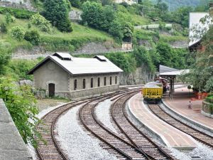
Cairo train station

Cairo is the capital of Egypt and, with a total population in excess of 16 million people, one of the largest cities in both Africa and the Middle East (which regions it conveniently straddles) - it is also the 13th largest city in the world. Situated on the River Nile, Cairo is famous for its own history - preserved in the fabulous medieval Islamic city and in Old Cairo - and for the ancient, Pharaonic history of the country it represents. No trip to Cairo would be complete, for example, without a visit to the Giza Pyramids, to nearby Saqqara, or to the Egyptian Museum in the center of town. Though firmly attached to the past, Cairo is also home to a vibrant modern society.
Cairo International Airport (IATA: CAI), is well served by Egyptair, the national carrier, and others such as British Airways, Air France, [KLM], Singapore Airlines and Lufthansa. Egypt Air now lands and departs from the domestic terminal, even for international flights.
Getting to downtown Cairo can be a pain. 40 LE is a good price by taxi, and refuse to pay the "ticket" (ie, airport toll) for the driver. For the adventurous, catch a public bus to Midan Tah Rir or Midan Ramses. Walk 5 minutes out of the terminal to the big undercover bus station, and ask a local, but don't catch the notorious green buses. Rides are just under 2 LE. It takes around 1 - 1.5 hours to reach downtown.
Cairo's main railway station - Ramses Station (Mahattat Ramses) - is located on Midan Ramses. Trains run to Cairo from most other regions and cities within Egypt.

Alexandria are served by a large number of departures throug the day. Among the best trains are the Espani which has a morning service from Cairo at 9am. The Espani and Turbobin are the best services, driving non-stop to Alexandria and taking 2 hours and 40 min. The next best service is al-fransawi, which stops at the major Delta cities on the road. Buy tickets one day in advance to be
Going to Upper Egypt, Luxor and Aswan, the Sleeping Trainleave Cairo 8 pm and arriving in Luxor 5.05 am and Aswan 8.15 am. Check the website for more departures, including one three days a week from Alexandria. It's relatively expensive at 60 USD for a bed in a double-person cabin one way. Tickets are bought at the office to your left as you enter the train station from the Metro and taxi station. The tickets are payable in US dollars only (there are no exchange offices at the train station itself).
Going to Upper Egypt, the alternative to the expensive sleeper (or flying) is the ordinary trains. One of these departs at 00.30 to Luxor and Aswan and is supposed to take 10 hours to Luxor and 13 hours to Aswan.
Trains also depart to the canal cities, but buses are much faster.
For those unfamiliar with Cairo traffic, one shouldn't expect to drive. The traffic is, at the least, overwhelming for the common traveler. Road signs, lanes, right-of-ways, etc. are not adhered to. The driving has a consistency, but not in any official way. Parking houses or official parking spots are rare, but many places people work to look after parked cars. A small tip is expected for this service.
Getting in and out of Cairo, the roads to and from Fayoum and the destert cities in the south-west and Alexandria, Delta and Marsa Matrouh in the north-west are through the Giza and pyramids area, the road to Beni Suueif and Upper Egypt (Aswan, Luxor) is in the south, after Maadi and Helwan. North from Heliopolis are the road to the canal cities (Port Said, Ismailiyya, Suez) and Sinai. Ein al-Sukhn and Hurghada is best reached by the tolled road after New Cairo City.
Buses arrive to Cairo from virtually all over the country. The two main destinations are Midan Ramsis and Turgoman, but vechiles also sometimes stop at other destinations, notably abbasiya. From Midan Ramses and Turgoman it's a quick 5 EP taxi cab ride to downtown, 7-10 EP to Zamalek.
The Turgoman has, from 2007, been renovated into a new, modern indoor station, close to the older one
From Turgoman, hourly services run to the canal cities (2 hrs) and Sharm al-Sheikh. To Sharm, the East Delta is taking approximately 8 hrs. The Superjet is faster, driving non-stop without a break in approximately 6 hrs. Three of the East Delta services continue to Dahab. Fares for the East Delta is approximately 80 EP for foreigners.
Services also go to Taba and Nuweiba, leaving three times daily (including one night services) with prices comparable with the services to Sharm. It takes 6 hrs all the way to Nuweiba.
To the canal cities, Port Said, Ismailiya and Suez, buses go all the time from Turgoman station, costing 20-30 EP. The travel to all destinations takes a little bit more than two hours.
Uncomfortable, but cheap, microbuses leave from Cairo to a large number of destinations. The main garages are Midan Ramsis and al-Marg metro station (for the north-east and Sinai). They are faster and might as such be an option for shorter trips, but have a terrible toll of acccidents. There are also other places these buses leave from depending on your destination, ask locals. Be aware that at least for Sinai, foreigners are prohibted to use the microbus system.

Tuesday, July 10, 2007

British Airways London Eye

British Airways London Eye

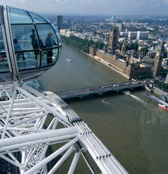
The British Airways London Eye is the world's tallest observation wheel at 135m high. Located on the banks of the River Thames it offers unrivalled views over London.

Since opening at the turn of the century, the London Eye has become an iconic landmark, with a status that can be compared to Tower Bridge, Big Ben, Eros and the Tower of London. It has been used as a backdrop in countless films and for innumerable TV programmes. A source of pride for the whole country as well as the capital, the London Eye is the most distinctive addition this century to the world's greatest city, loved by Britons and tourists alike.

In fact, in its short life, it has become the most popular paid for UK visitor attraction, visited by over 3.5 million people a year (an average of 10,000 a day). A breathtaking feat of design and engineering, passengers in the London Eye's capsules can see up to 40 kilometres in all directions, in complete comfort and safety.

But there's much, much more to the London Eye than its views and its engineering. It plays an integral role in the community, has become something of a gateway or a symbol for London and offers a unique venue for corporate events and entertainment.
The British Airways London Eye is operated by the London Eye Company Limited, a Merlin Entertainments Group Company.

Intercontinental Hotel in Amsterdam

AMSTEL INTER-CONTINENTAL

PROFESSOR TULPPLEIN 1
AMSTERDAM, 1018 GX
NETHERLANDS

Property Type: Hotel
Guest Rooms: 83
Directions: In the City Centre, on the Banks of the Amstel River.
From city center:
Direction: It is city center
Distance: 0 - 15 minutes
Area Airport: Amsterdam Schiphol International (AMS) - 20 km
24 Hour Front Desk
Express Check-out
Room Service
Indoor Pool
Business Center Facilities
Laundry/Valet Service
Safe Deposit Box
Tour Desk/Concierge
Mini Bar Rooms Available
Air Conditioned Rooms
Voice Mail in Rooms
Cable Television
Video Tape Player
Barber/Beauty Shop on site
Bar/Lounge on site
Restaurant on site
Shops on site
Hot Tub on site
Fitness Center on site
Other Features: Fax, Tanning Bed & Massage, Secretarial Services

Need A Room?

Monday, July 9, 2007

Hurghada Egypt

Hurghada Egypt

Hurghada was once a fairly small and unimposing fishing village, located next to the Red Sea and boasting a number of superb beaches. Today, the resort of Hurghada is almost unrecognisable from its past life and has grown to become probably the most visited tourist destination in the whole of Egypt, with in excess of 100 different hotels, many of which line the shoreline.
Famous for its superb diving opportunities, Hurghada is especially appealing to those with little experience of scuba diving, who come to marvel at the underwater reefs and awesome marine life. Tourism is now a huge part of Hurghada and each year, many tourists choose to combine their holiday here with visits to other prominent locations along the Nile Valley, including the relatively nearby city of Luxor.
Hurghada's foremost tourist attractions include its beautiful beaches, which have long been a major drawcard in the town and boasting white, fine sand and many spectacular coastal views, with many beaches being located next to hotels. Other top tourist attractions in Hurghada include the vibrant and rather colourful local market of Bazaar in Ed-Dahar, the marine life at the Red Sea Aquarium, and also the many underwater attractions and breathtaking coral reefs at the Giftun Islands. More information on Hurghada Tourist Attractions.
Around the tourist resort of Hurghada you may be surprised to find a number of rather historical landmarks. Amongst the most notable are the monasteries of both St. Anthony and St. Paul, although the Roman site of Mons Claudianus is particularly impressive and was in use for more than 200 years. Also of interest is Hurghada's Anfish Mountain, which provides some of the best views of the Red Sea, the town and beyond. More information on Hurghada Landmarks.
Several good museums and pleasant art galleries exist in the town of Hurghada. The best offerings include the Marine Biology Museum - complete with many underwater sights, biology station and information about local marine life, the National Museum - a new addition to the city's tourist attractions and showcasing many treasures found in the Eastern Desert; and the Café del Mar - where paintings are displayed in restaurant surroundings. More information on Hurghada Museums and Art Galleries.
Close to Hurghada you will find many of Egypt's top tourist attractions and most impressive resorts. A particularly favourite is Sharm el Sheikh, which lies alongside the Gulf of Aqaba and is famous for its scuba diving and sandy beaches, while on the south-western side of Hurghada, the provincial capital of Qena contains a particularly impressive temple complex. Also within reach of Hurghada, the city of Luxor is without equal and full of awe-inspiring monuments, such as the Valley of the Kings. More information on Hurghada Attractions Nearby.

Wednesday, July 4, 2007

Lepenski Vir

lepenski vir idol

Lepenski vir, a unique prehistoric discovery, was brought to light about twenty years ago.

The most important finds in the well laid-out settlement are a number of monumental stone sculptures made some six to seven thousand years ago.

Nothing comparable has ever been unearthed in relation to such early prehistoric periods in the Balkans and the Danube basin.

Particulary valuable to the study of the history of culture and art in the prehistoric Europe are the worked round boulders and marked slabs also found there.

In last few years in the Iron Gate area a separate prehistoric culture was discovered and researched — the culture of Lepenski Vir — which chronologically and culturally links the culture of the Late Paleolithic of this area with the oldest Neolithic culture of the type Starcevo—Körös—Kris. Beside varied and rich archeological finds — the remains of dwelling places, stone sculptures, stone receptacles and altars, as well as of stone and bone industry — in the find-spots of the culture of Lepenski Vir were also discovered the graves which, by their numerousness and stratigraphical position, enable the insight into the way of burying and burial rites practiced through a long time span from about 8000 B. C. till about 5.500 B. C.

For the present, nine settlements of the Lepenski Vir culture are known, four of them on the right bank of the Danube (Lepenski Vir, Vlasac, Hajducka Vodenica, Padina) and five on the left bank (Veterani, Terrasse, Icoana, Razvrata, Ostrovul Banului, Schela Cladovei). While some of these settlements have been investigated as a whole or for the most part (Lepenski Vir, Vlasac, Padina, Schela Cladovei), in the others were carried out only smaller sounding excavations. However, without regard to the degree of investigation of some settlements, it is of importance to note that the data concerning the graves found in them tune into each other, i.e. that they point to the same ways of burying and the same burial rites. The most abundant data in respect of the way of burying and burial rites give the graves from Vlasac, Lepenski Vir and Schela Cladovei. At Vlasac were found 84 graves (110 dead), at Lepenski Vir 82 and at Schela Cladovei about 20.

On the basis of vertical stratigraphy and archeological material, the culture of Lepenski Vir has been divided into two phases: the earlier, represented by the levels Vlasac Ia, b, Proto-Lepenski Vir and Lepenski Vir Ia, b, and the later phase, which includes the settlements Icoana, Schela Cladovei, Vlasac II—III, Lepenski Vir Ic-e, Lepenski Vir II, Padina and Hajducka Vodenica. In both phases the dead were buried within the settlements. However, by time, the way of burying and of burial rites changed. The graves, deriving from the level which represents the earliest phase of the culture of Lepenski Vir show that from the very beginning of this culture the dead were buried in various ways, i.e. that complicated burial rites were practiced...

Sunday, July 1, 2007

Keltic Lodge Resort and Spa

Keltic Lodge Resort and Spa

Another Nova Scotia beautiful spa. Keltic Lodge Resort and Spa .
Surround yourself with the rugged glory of Cape Breton. High on a cliff, overlooking the Atlantic Ocean, Keltic Lodge commands a view like no other and beckons you to relax and enjoy the splendor of the Highlands.

A view of majestic Cape Smokey rising out of the sea greets your arrival at Keltic Lodge. Whether you stay at the Main Lodge, the Inn at Keltic or one of our cozy two - or four-bedroom cottages (each with its own fireplace), your comfort is assured.

Now that you've made good your highland escape, there are so many ways to fill the day. Tour the world-famous Cabot Trail. Hike along wilderness trails that wend through centuries-old forests. Take a boat cruise on the ocean and watch for whales. Play a game of tennis or enjoy the sun, sand and surf of nearby Ingonish Beach. Or plunge into our heated, outdoor pool.

Nearby, the Highlands Links golf course - ranked by Golf Magazine as Canada's Top Public Course and 64th in the world, challenges you to 18 championship holes. A course rich in the Scottish tradition, restored to Stanley Thompson's magnificent original design.

A romantic, candlelight dinner in our Purple Thistle Dining Room is the perfect end to the perfect day. Here, seafood delicacies (the Chef's speciality) and other gourmet delights are served, overlooking the Atlantic Ocean. The Highland Sitting Room features nightly entertainment, and you can try the Atlantic Restaurant for a quick snack or hearty informal meals.

Escape to Keltic Lodge where our natural beauty and gracious ways will lure you here time and again.

Digby Pines Spa - Nova Scotia

Digby Pines Spa

Digby Pines Golf Resort and Spa has been welcoming guests to this Norman- Style Chateau overlooking the beautiful Annapolis Basin since 1929. The Chateau features 84 well appointed rooms and suites. For a more intimate, secluded setting choose from among the 30 one, two and three bedroom cottages nestled around the spacious grounds. Each has its own cozy living room with a fireplace and verandah.

Relaxing is easy - especially when you're surrounded by such breathtaking beauty. Spend an afternoon by our heated, outdoor pool. Walk or run the wooded hiking trails. There's tennis, lawn croquet, shuffleboard and a full fitness centre. Or try our par 71, 18 hole picturesque golf course, one of Sir Stanley Thompson's masterpieces.

Nearby, you'll find whale-watching cruises on the Bay of Fundy and some of the country's most historic sites. Visit the Port Royal habitation, the French settlement that gave birth to the New World of Canada. And drop into Canada's first National Historic Park, Fort Anne in Annapolis Royal.

For a true taste of dining luxury, experience the award winning cuisine of our famed Annapolis Room. Casual meals and snacks are served on the Verandah overlooking the basin and at the 19th Hole offering a panaoramic view of our prized golf course. Or relax at the poolside patio and enjoy a cool refreshment or a delicious ice cream treat.

For romance, fun or just a much needed rest, make us your destination. Digby Pines Golf Resort and Spa. Old- world elegance. World- class cuisine, In The Classic Manner.

Wednesday, June 27, 2007

Top beaches for romance travel

Hawaii romantic travel beach

Travel Channel made a list of The best beaches for romance vacation. In fact, they made 2 top lists, and there they are:

Top 12 U.S. Beaches for romance

Cannon Beach, Ore.
Cape May, N.J.
East Hampton, N.Y.
The Mauna Kea, Hawaii
Poipu Beach, Hawaii
Santa Barbara, California
Shi Shi Beach, Washington
Siesta Key, Fla.
Southampton, N.Y.
St. John, U.S. Virgin Islands
Trunk Bay, St. John, U.S. Virgin Islands
Wailea, Hawaii

Top 13 World romantic Beaches

Anse Source d'Argent, Seychelles
Clifton Beach, South Africa
Crete, Greece
Culebra Island, Puerto Rico
Datai Beach, Langkawi, Malaysia
Grand Cul-de-Sac, St. Bart's
Larvotto Beach, Monaco
The Maldives Islands
Maroma Beach, Mexico
Natadola Beach, Fiji
Negril, Jamaica
Ofu Beach, American Samoa
Pink Sands Beach, Bahamas

Romantic beach guide on Travel Channel


AddThis Social Bookmark Button

Monday, June 25, 2007

Cadiz - Mediterranean Spain tourism

The closest airport is Jerez de la Frontera, approx 30 minutes by car or taxi (fixed price €46), 1 hour by direct bus. There are several daily flights to Madrid and Barcelona (Iberia, Spanair, Vueling). Ryanair fly daily to London Stansted and Frankfurt Hahn. Other operators fly scheduled, charter, or seasonal flights. The nearest major airports are in Sevilla (hour by car, 2 hours by bus or train) and Malaga (2-3 hours by car or bus).
Buses run to and from Seville, Jerez, Algeciras, etc. A ticket from Jerez to Cadiz is about 10 euro. For Jerez-Cádiz timetables see Consorcio de Transportes Bahia de Cadiz.
Frequent trains run to Jerez and about hourly to Seville. A very convenient way to come in from Madrid is with the Talgo train that runs twice a days covering the distance in about 5 hours. See RENFE for timetables.
From Madrid, Cordoba and Seville you can use the A4, from Barcelona N340. A taxi ride from Jerez de la Frontera to Cadiz costs about 50 euros.
A modern monument of Cadiz are the huge pylons of the powerline crossing the bay of Cadiz. These 150 metre high pylons are lattice towers with cylindrical cross section.
Everyone should visit the Cathedral in the old town and climb to the top of the cupula for a nice view of the entire city.
The Torre Tavira, near the Central Market (Mercado de Abastos) is a 19th century camara oscura in perfect working order. Located in one of the towers originally used by merchants to watch out for their ships returning home from the Americas, it provides a birds-eye view of the old part of town.
Get to Cadiz for Carnaval, usually in February, one of the oldest and best in Spain.
Semana Santa (Easter or Holy Week) is less formal than in Sevilla, and probably more authentic and emotive an experience for that.
Enjoy the best sunset in Spain on 'la playa caleta' on the southern end of old Cadiz. The main beaches (Santa Maria Del Mar, Victoria, and Cortadura) start at the edge of the old town, continue all along the edge of the new town, and on alongside the road to San Fernando. In total some 10 km of the widest, cleanest beaches you will find in Europe, with safe bathing from around May to October. The summer heat is usually tempered by an Atlantic breeze, although on days when the Levante blows beware of flying sand.
In Cadiz you will find some of the best and freshest fish and shellfish in the world. They are best eaten as simply cooked as possible: plain boiled shellfish (in varying sizes from tiny prawns up to lobsters), grilled or baked whole fish such as lubina (bass) or dorada (bream), or deep fried with a light flour coating (especially puntillitas (baby squid) and boquerones (anchovies).
Fino, a bone dry sherry (or Jerez), or manzanilla, a similar wine from Sanlucar de Barrameda, is the perfect aperitif with olives or a prawn or two. Drinking more than a couple of glasses may spoil your focus on the rest of the meal. The best local white wine (and one of the most popular in Spain) is Barbadillo, made from the same grape but considerably lighter.
Casa Caracol - Inexpensive and quite relaxed hostel on the old part of Cádiz. Visit www.caracolcasa.com for prices and reservations.
Hostal La Cantarera is an excellent hostel for what it costs, with clean, luxurious rooms and friendly management, located in the old town.

Friday, June 22, 2007

Rhodes

Rhodes is the largest Greek island of the Dodecanese group of the South Aegean Islands of Greece. It is known for the Colossus, one of the seven wonders of the ancient world, which was sadly destroyed.

Rhodes has everything from beautiful beaches to a lush, green interior, a bustling capital and one of the best sunshine records in Greece. The rock-rose is so prolific here that it has been named the 'Island of Roses' and while the northern coast is renowned for its lively tourist resorts the south offeres tranquil beaches and a slower, more simple pace of life.

Cities on Rhodes


* Rhodes city - The biggest city on the island and seat of the local government
* Lindos - Small village with an old acropolis. Located around a small hill. No cars are allowed in the large areas of the town.
* Haraki - Small former fishing village located next to Lindos.
* Pefkos - A smaller tourist resourt close to Lindos. Originally started as a small collection of farms and private residences, but has grown into a town in its own right.
* Faliraki - Rhodes' "action resort". Go there to party, everything else is better somewhere else.
* Kalithea - snorkeling and resort hotels.
* Lardos
* Gennadi
* Afandou - One of the big villages on the island. The golf course of Rhodes is situated in this area along with a long beach
* Ixia - West coast resort, close to Rhodes city
* Theologos - A traditional village

Rhodes info


The local tourist information office for the Dodecanese Islands is located in Rhodes city at Makariou & Papagou Corner (opposite the New Market). Telephone 22410 44335-6, Fax 22410 26955.

Beaches on Rhodes


There is a good variety of beaches on Rhodes. The east side of the island has almost continuous sandy beaches with calm waters. Beaches on the west are mostly more stony. The wind mostly comes in from the west and also the sea tends to be somewhat rougher to the west so that side of the island is better suited to surfing or kite boarding.

* Rhodes Town.
* Lindos. The stunningly beautiful town beach on the bay. Very trendy, so wear your thong bikini here if you want to fit in.
Lindos Beach, as seen from Lindos village
* Kalithea. Just north of Faliraki, this was originally an Italian built spa. It is very pleasant spot but can be crowded. Currently building work is ongoing to build what looks like it will be a modern spa adjacent to the original buildings. A number of separate beaches, each seemingly with their own taverna lie just south of the spa.
* Faliraki. A long sandy beach with plenty of tavernas to choose from. There is also no shortage of people to rent jet skis from or to organise other activities. At the southern end, there is a quiter, more rocky beach but the sea there is inconveniently shallow for swimmers. There is also a nudist beach a little further South.
* Ladiko Beach (Anthony Quinn Bay). This is a very scenic spot. On one side of the bay is a relatively small beach. The other side is rocky but a man made platform provides further space for sunbathing and access to the sea.
* Afandou Beach
Afandou Beach
Afandou Beach
* Kolymbia Beach.
* Tsambika Beach
* Gennadi Beach
* Agia Marina Beach


AddThis Social Bookmark Button

Wednesday, June 20, 2007

Santorini - Greek island

Santorini island panorama

Santorini (Greek Σαντορίνη, IPA: ˌsa(n)do̞ˈrini) is a small, circular archipelago of volcanic islands located in southern Aegean Sea, about 200 km south-east from Greece's mainland. It is also known as Thera (or Thira, Greek Θήρα, IPA: ˈθira). It is the southernmost member of the Cyclades group of islands, with an area of approximately 73 km² (28 mi²), and in 2001 had an estimated population of 13,600. Santorini is essentially what has been left from an enormous volcanic explosion which destroyed the settlements thereon and led to the creation of the current geological caldera. Its spectacular natural beauty along with its eminent nightlife make the island one of Europe's top tourist hotspots.

A giant central lagoon, more or less rectangular and measuring about 12 km by 7 km (8 mi by 4 mi), is surrounded by 300 m (984 ft) high, steep cliffs on three sides. The island slopes downward from the cliffs to the surrounding Mediterranean sea. On the fourth side, the lagoon is separated from the Mediterranean by another much smaller island called Therasia. The lagoon merges with the sea in two places, in the northwest and southwest. The water in the centre of the lagoon is nearly 400 m (1,300 ft) deep, thus being a safe harbour for all kinds of ships. The island's harbors are all in the lagoon and there are no ports on the outer perimeter of the island. The island's capital, Fira, clings to the top of the cliff looking down on the lagoon.

It is the most active volcanic centre in the South Aegean Volcanic Arc, though what remains today is largely a water-filled caldera. The name of Santorini was given to it by the Latin empire in the thirteenth century and is a reference to Saint Irene. Before then it was called Kallistē ("the most beautiful one"), Strongylē ("the circular one"), or Thera.

The island was the site of one of the largest volcanic eruptions in recorded history when it erupted cataclysmically some 3,500 years ago, at the height of the Mycenaean epoch. The eruption left a large caldera surrounded by volcanic ash deposits hundreds of feet deep and, according to a theory, its effects may have indirectly led to the collapse of the Minoan civilization on the island of Crete, 110 km (70 mi) to the south, due to a gigantic tsunami. Another popular theory holds that the Thera eruption is the source of the legend of Atlantis (see below for detail).

Modern Santorini

Santorini was annexed by Greece in 1912. Major settlements in Santorini include Fira (Phira), Oia, Emporio, Kamari, Imerovigli, Pyrgos and Therasia. Akrotiri is a major archaeological site with ruins from the Minoan era. The island has no rivers and water is scarce. Until the early nineties locals used to fill water cisterns from the rain that fell on their roofs and courts, from small springs as well as by importing it from other areas of Greece. Nowadays, there is a desalination plant that provides running, yet nonpotable, water to most houses. The primary industry of Santorini is tourism and in the summer the island can get quite crowded. The pumice quarries have been closed since 1986 in order to preserve the caldera of Santorini. Santorini is home to a small but flourishing wine industry, based on the indigenous grape variety, Assyrtiko. Assyrtiko vines are extremely old and are resistant to phylloxera, attributed by local winemakers to the well drained volcanic soil and its chemistry. Consequently they did not need to be replaced during the great phylloxera epidemic of the early 20th century. Assyrtiko vines are well adapted to the Santorini habitat and are planted far apart, as their principal source of moisture is dew. They are trained in the shape of low spiraling baskets, with the grapes hanging inside to protect them from the winds. Also unique is the red, sweet and extremely strong Vinsanto. White wines from the island are extremely dry with a strong, citrus scent; the ashy volcanic soil gives the white wines a slight sulphurous flavor much like the Visanto. It is not easy to be a wine grower in Santorini; the hot and dry climate gives the soil a low productivity. The yield per acre is only 10 to 20% of the yields that are common in France and California.

Santorini red beach

In 1707 an undersea volcano breached the sea surface forming the current centre of activity at Nea Kameni, and eruptions centred on it continue — three times in the twentieth century, the last being in 1950. Santorini was also struck by a devastating earthquake in 1956. At some time in the future, it will almost certainly erupt violently again. Although the volcano rests at the present time, at the current active crater [there are several former craters on Nea Kameni] steam and sulphur are given off.

Santorini island is the main location for the film Summer Lovers and subject of a large number of documentary films.

Alistair MacLean's Santorini is a fiction story that takes place in the sea area around the island.

Santorini for tourists

Santorini island could be divided into two parts, the western side of the island and the eastern. To its western side owes Santorini, mainly, its popularity. It is where the caldera is, and the villages, like Fira and Oia are, that are built on the cliff. Therefore on this side of Santorini most hotels have terrific views, of the caldera, volcano, sea and sunset. There is of course a drawback that you have to keep in mind before making your reservation. The majority of the hotels built on the caldera have many stairs, which is usually annoying for tourists not willing to climb up and down all the time. Some of them do not accept children under 13, because they do not offer any children facilities, due to their dangerous location on the cliff. There are hotels that are specially oriented to couples and honeymooners. Most of Santorini luxurious resorts can be found on the western side of the island. Note that not all hotels, which are on the western side of the island offer view, as some of them are located in town.

The eastern side of Santorini resembles to the rest Greek islands. There are many beach hotels, especially in Kamari, that attract also a lot of tourists, mainly youngsters and families. These hotels usually offer larger rooms and pools than those on the other side of the island.

Keep in mind that the rooms’ rates are fixed, by many hoteliers, according to the view of the room,which makes the hotels on eastern side of Santorini much cheaper than those on the western side.

Moreover keep in mind that booking your accomodation in advance would be very helpful, as most hotels have few rooms (usually not more than 20) and get easily full.

Most of the island's hotels are closed during winter. They open during or after Greek Orthodox Easter (April or May) and usually close by the end of October. As in other Greek Islands, July, August and September are considered high season.

Monday, June 18, 2007

Kopaonik mountain

Kopaonik is the largest mountain in Serbia, more then 100 km long. Its highest peak is Suvo Rudiste (also called Pancic's Peak) at 2,016 m above sea. The duration and quality of snowfall and ideal skiing grounds have been attracting a rapidly increasing number of guests.
Kopaonik was declared a national park in 1981. The national park spreads on 12,000 hectares. A vast high mountainous and relatively flat region at an altitude of about 1,700 meters forms the basis of this national park. This central Kopaonik plateau is called Suvo Rudiste. It is surrounded by mountain peaks. To the north and northwest of this plateau stretches Banjski Kopaonik below which is the well-known Josanicka Banja spa with its strong springs whose waters reach the temperature of 88 degrees Celsius. Directly below the Suvo Rudiste plateau starts the attractive and picturesque valley of the Samokovska River, characterized by its steep run, numerous rapids, falls and gorges.
Kopaonik's flora is characterized by a large number of autochthonous plant species (the Balkan beech, fir, spurce, yew, several kinds of maple, pine and oak). The fauna is also diverse but its concentration varies, depending on the quality of the habitat.

This mountain has enormous resources for the development of tourism. The entire park is characterised by its extraordinary natural beauty: vast expanses of grassland, picturesque forests composed of a wide variety of tree species, beauty spots, deep river gorges. The snow blanket lasts a long time on this mountain and in view of its good relief, there are excellent conditions for the further expansion of winter tourism there.
The tourist resort on the Kopaonik includes hotels, rest houses, ski lifts, excellent ski slopes and many other tourist facilities.

The Kopaonik is well-connected with the main transport routes in Serbia. The central part of Kopaonik with the tourist center and ski slopes is linked with the Ibar Highway by a modern tarmac road. The nearest airport is in Nis.

Kopaonik climate


As regards climate, Kopaonik significantly differs from the neighboring mountains, a fact which can be seen from the meteorological records for Raška, Kosovska Mitrovica and Ravni Kopaonik. The first lies at an altitude of 417m, the second at 526m and the third at 1710m above sea level. The first two have very similar temperatures, which is a result of their being located in a valley at a lower altitude. In Raška the median yearly temperature is 10.7°C, in Kosovska Mitrovica 10.5°C and on Ravni Kopaonik only 3.7°C. The January temperatures at the three meteorological stations are -0.4°C for the first, -0.2°C for the second and -5.2°C for the third. The shifting of the temperature maximum of Ravni Kopaonik to august indicates it has a sub-alpine climate. The winter temperatures on this mountain are not very low as a result of its southern position, flatness and wide-open terrain, which prevent the piling up of clouds and cold air and facilitate ventilation. The cold winter air is heavy and moves through the neighboring valleys and ravines. Spared a long-lasting cloud cover, Ravni Kopaonik is exposed to the sun for a longer period of time in winter, making it warmer than might be expected in Naturally, this is "wintry" sunshine, so the snow does not melt for five months (its duration is a average 159 days a year). This is why the ski season is long and stable here.
With 200 sunny days a year (in Suncana Dolina), this mountain seems to have been made for a resort with plenty of fresh air. Thus city dwellers enjoy coming here both in summer and in winter. In July and August negligible amounts of rainfall come in short-lasting showers, after which the weather is fine again. Therefore, during the winter and summer tourist seasons, which bring in the largest number of visitors, there is little precipitation. Such a climate has a great effect on health, a fact that is acknowledged by the experts as well.


Kopaonik nature vacation


Waters, thermo-mineral springs and spas


Kopaonik would not be so attractive had nature not be quested it with an abundance of cold, radioactive and thermo-mineral waters.
Walking through the tall grass of the Kopaonik meadows, one often steps into a brook or pillowy bog, which sprays the passer-by like a sodden sponge, which had been pressed. When all these creeks and rivulets come down from Ravni Kopaonik to the foothills and flow into the Jošanica, Samokovska or Graševacka rivers, they begin to foam, rumble and thunder. Only this eternal mountain roar reaches the absolute quiet of the fir and spruce forests and the seemingly monotonous pastures. Climbing down to one of these piedmont rivers, one notices a multitude of cevrntije-giant stone cauldrons with whirlpools of foaming water. Frequent watermills and an occasional rolling mill complete with weir, sluice and water wheel, add to the vividness of the attractive foothills scene.
Quite a few radioactive springs are hidden above all these streams, rivulets and their sources. Some of them cling to the very tops of the mountain-Krcmar Voda emerges at 1950 meters above sea level, just below Pancicev Vrh (Pancic's Peak); Marina Voda at 1700 meters; Pajino Preslo and Kaznovske Bacije at almost the same altitude. Every one of these springs has more then 11.5 Mach units of radioactivity. Krcmar Voda, with 74 Mach units, is the most radioactive spring in Yugoslavia. Very cold and slightly mineralized, this water is a particular natural asset of Kopaonik.
Many thermo-mineral springs are found in the foothills of Kopaonik and at places of marked fissuring-in Jošanicka Banja, Bogutovacka Banja, Lukovska Banja and Kuršumlijska Banja, to mention but a few of the nearest thermal springs. "Following Velika Cesma in Vranjska Banja (92°C), the second hottest spring in our country is the main spring in Jošanicka Banja (78.5°C). The springs are curative…" The water of Jošanicka Banja is used for treatment by bathing, drinking, gargling and inhaling.
Lukovska Banja, a natural spa well know since the Roman age lies in the eastern piedmont of Kopoanik, at an altitude of 700m above sea level. It boasts eight springs with alkaline mineral water, whose temperature varies from 36°C to 56°C. Mud baths with a temperature of 37.5°C are also used for therapeutically purposes.
Kuršumlijska Banja, south of Kuršumlija, also in the eastern piedmont of Kopaonik, is a health spa "with one spring bordering upon another". There are ten springs of sulphurous water there, their temperatures being from 38°C to 57°C. Another produces alkaline mineral water of 30°C.
Bogutovacka Banja lies on the left bank of the Ibar and not directly below Kopaonik itself. However, it is very close to the mountain and its got water coming to the surface is a consequence of tectonic movements in the wider Kopaonik region. It has three springs of slightly sulphurous and radioactive, hypothermal water, with a temperature of 24.7°C.
We have mentioned only those thermo-mineral springs and spas which are situated either in the foothills of Kopaonik or very close by. Other well-known spas lie within a radius of 50 kilometers: Vrnjačka Banja, Mataruška Banja, Novopazarska Banja as well as many small thermae that have not yet been developed.
All the natural splendor of Kopaonik is not yet well-known or sufficiently exploited. The mountain is noted for its abundance of strawberries, blackberries, raspberries and bilberries. The eastern slopes of Rendara and the northern sides of Pancicev Vrh have miles of bilberry groves, which bring scores of people out from the nearby villages to pick the fruit in August. In the last ten years or so, Kriva Reka, the highest village on Kopaonik (about 1250 meters above sea level) has become better known due to the cultivation of raspberries and currants.
Because of all these natural characteristics and beauty, the great Yugoslav scientist, Josif Pancic, was especially fond of Kopaonik. He climbed it sixteen times-the last time at the age of 72. Enjoying the splendors of Kopaonik, on several occasions he expressed his wish to be buried there. His wish was fulfilled only in 1951 when his remains were transferred and buried on the highest peak, which was named after this great man (Pancicev Vrh-2017m above sea level). The founder of the Serbian Academy of Sciences, a man who explored and admired this mountain for so long, now lies there forever.

Source: Dr Milorad Vasovic
"Planina sunca i snegova"
Turisticki savez Srbije, 1982.

Kopaonik Information and Accommodation


Hotel "Grand" (****)
36354 Kopaonik
Phone: +381 36 71027, 71010

Hotel "Jugobanka" (**)
36354 Kopaonik, Suvo Rudiste
Phone: +381 36 71040

Hotel "Junior" (**)
37225 Brzece
Phone: +381 37 825051, Fax: +381 37 823033

Hotel "Olga Dedijer" (***)
36354 Kopaonik
Phone: +381 36 71033, Fax: +381 36 71125

Hotel "Putnik" (***)
36354 Kopaonik
Phone: +381 36 71030, 71038, Fax: +381 36 71038

Hotel "Putnik klub A" (****)
36354 Kopaonik
Phone: +381 36 71600, Fax: +381 36 71606

Hotel "Srebrnac" (**)
36354 Kopaonik
Phone: +381 37 827744, Fax: +381 37 827711

Apartment Complex "Investbanka" (****)
36354 Kopaonik Suvo Rudiste
Phone: +381 36 71301

Apartment Complex "JAT" (****)
36354 Kopaonik
Phone: +381 36 71013

Apartment Complex "Konaci suncani vrhovi" (****)
36354 Kopaonik
Phone: +381 36 71977, 71010

Apartment Complex "Kopaonik" (***)
37225 Brzece
Phone: +381 37 833130, Fax: +381 37 833199

Apartment Complex "Nebeske stolice" (****)
36354 Kopaonik
Phone: +381 36 71247

Apartment Complex "Ragione"
37225 Brzece
Phone: +381 37 827707, Fax: +381 37 827707
Friday, June 15, 2007

Sokobanja Spa

Sokobanja Spa

Sokobanja (Sokobanja Spa) is situated in the eastern Serbia, at the height of 400 m above sea level and it ranks among the first ecological municipalities in Serbia.

Situated on the slopes of the mountains of Ozren and Rtanj, surrounded by natural sources of oxigen and ozone, on the banks of some-times peaceful and sometimes rapid noisy river Moravica - lies Sokobanja.
This urban point showing a number of evidence of its long existence is now the center of the first ecological municipality in Serbia.
Altitude of Sokobanja, negative ionization of air; natural crossing point of mild winds above the town, and the abundant springs of ther-mal waters offer a magical experience. The experience has in a most appropriate manner been expressed by Serbian famous comedist Branislav Nusic: "Sokobanja, Sokograd - one comes old and leaves young." Nusic and many other important people, such as the winner of the Nobel Prize, writer Ivo Andric, have always returned to Sokobanja till the end of their lives.
Sokobanja is a holiday heaven. An active one, of course. Whether you will decide to walk around the spar from shade to shade in summer; or from scenery to scenery in spring, fall or winter; whether you will choose your favourite sport, or go to the pool, to the river, to the nearby Bovan Lake for a swim and to enjoy fishing, in the mountain to find some sweet-smelling medicinal herbs, with which these slopes are the richest in Europe, for your own home pharmacy; whether you will visit the library, chess club, museum, gallery, caffee, find some night enter-tainment ... all the time you will be filling your lungs with oxigen, your step getting brisker and brisker; respiration easier you will be relaxing and resting.

Sokobanja has sport fields, hunting and fishing zones. The guests have at their disposal numerous soccer and basketball fields and tennis courts, as well as 20 km long "health" trim path.

Curative Factors:
A temperature of the thermal-mineral spring waters is from 28 to 45.5 degrees Centigrade.

Sokobanja Spa is Recommended for:
- Diseases of respiratory organs with children and adults: (Bronchial asthma, acute and chronical bronchitis, sinusitis, emphysema, bronchiectasis, respiratory insufficiency, postpneumonic states, other frequent respiratory infections and alergical manifastations, especially with children)
- Rheumatic diseases (Rheumatism of peripheral joints and spinal column, other types rheumatism, etc)
- Post-traumatic states
- Chronical gynecological ilnesses
- Neurological diseases: (Neuralgia, radiculity, states after injuries of peripheral nervs)
- Parcinson's disease (less developed forms)
- Stress syndrom
- Psychical and physical exhaustion
- Lighter forms of hypertension

THERAPIES in Sokobanja Spa:

- INHALATION THERAPY is made in natural inhalator "Park", aparature inhalator in "Novi zavod" and "Sokograd" buildings.
-RESPIRATORY REHABILITATION - Disobstruction of respiratory paths (inhalation, drainage of bronchias), respiration exercises, conditioning, corrective exercises.
- HYDROTHERAPY - depending on indications these are made in hypothermal water at temperature ranging from 28 to 30C, or in bath facility "Banjica", or in baths "Park" or "Sokograd", or in thermal water at temperature ranging from 36 to 38C. Inhalation therapy is made in natural inhalator "Park", aparature inhalator in "Novi zavod" and "Sokograd" buildings.
-PHYSICAL THERAPY - Hydrotherapy (in pool or in bath), hydrokinesis therapy, underwater massage, paraffin, IR, laser; galvanization, medicament electrophoresis, electrostimulation, DD, IFC, SWD, US, mechanotherapy.

Special Programmes in Sokobanja Spa:
Treatment and rehabilitation of children suffering from unspecific lung diseases.

Sokobanja Spa hotel

accommodation:
Natural Health Centre "Banjica"
M. Pejovica 40, 18230 Sokobanja
Phone: +381 18/ 830 204
Fax: +381 18/ 830 308

Hotel "Moravica"(***)
Timocke bune 4, 18230 Sokobanja
Phone: +381 18/ 830 622
Fax: +381 18/ 830 135
E-mail: hotelmoravica@bankerinter.net

Hotel "Sunce"(***)
Radnicka 3, 18230 Sokobanja
Phone: +381 18/ 830 122
Fax: +381 18/ 830 047

Hotel "Turist"(***)
Svetog Save 20, 18230 Sokobanja
Phone: +381 18/ 830 510
Fax: +381 18/ 830 510, 830 659

Hotel Zdravljak"(***)
Miladina Zivanovica bb, 18230 Sokobanja
Phone/Fax: +381 18/ 830 722, 830 742

Vrnjacka Spa

Vrnjacka Spa

Vrnjacka Banja (Vrnjacka Spa) is situated in the central Serbia, at the height of 230 m above sea level.
Thanks to springs of warm and cold mineral waters, and modern medical services Vrnjacka Banja successfuly cures diseases of digestive organs, diabetes, kidney and urinary vessels, cardiovascular diseases...

The tourism development of Vrnjacka Banja had started as far back as in 1868. This is an area where the Middle Ages encounter the modern times at every step. There are the most significant monuments of the Serbian medieval culture, especially monasteries with impressive fresco paintings. UNESCO protects some of them as world cultural heritage, such as monastery complexes - Studenica and Sopocani (12 c.). Other significant monasteries in the near vicinity of the Spa are: Ljubostinja, Zica, Ras, Djurdevi Stupovi and others.

Curative mineral water springs, natural beauty of this region full of green parks, walking and bicycle paths, as well as those suitable for mountain climbing, are only a part of rich and diversified tourist offer.

Throughout the year and especially during the summer holiday season, Vrnjacka Banja offers to its visitor's exceptionally rich and diverse cultural and entertainment programmes.

A special attention is paid to the facilities for guests' recreation, as well as for fitness training of both amateur athletes and top professional teams. There are fields for soccer, handball, volleyball and trim paths through the pine forest. In the near vicinity is the Goc Mt. with ski tracks and ski lifts.

Curative Factors:
Mineral waters of Vrnjacka Banja belong to two categories: warm mineral waters of 36.5 degrees Centigrade and cold mineral waters of 14, 17 and 25.7 degrees Centigrade.

Vrnjacka Spa is Recommended for:
Diabetes, diseases of the organs of the digestive tract, gall bladder, bile ducts, liver, then chronical gynecological and rheumatic diseases.

Treatment Methods in Vrnjacka Spa:
Electro, hydro, kinaesy*, magnetic, paraffinic, laser and ultrasonic therapy.

Drinking mineral water, bathing in mineral water, inhalation with warm mineral water, clysma and vaginal sprinkling with warm mineral water.

Special Programmes:
School for diabetes and "linea" - treatment of adipose.

Vrnjacka Spa accommodation

accommodation in Vrnjacka Spa:
Hotel "Beograd"
Vrnjacka bb, 36210 Vrnjacka Banja
Phone/Fax: +381 36/ 661 807

Hotel "Breza"(***)
Vrnajcka 26, 36210 Vrnjacka Banja
Phone: +381 36/ 662 140, 662 059
Fax: +381 36/ 665 969

Hotel "Fontana"(***)
Cara Dusana 2, 36210 Vrnjacka Banja
Phone: +381 36/ 661 153, 661 154, 661 564
Fax: +381 36/ 661 564

Hotel "Orion"
Bulevar Srpskih ratnika bb, 36210 Vrnjacka Banja
Phone: +381 36/ 661 263, 664 753
Fax: +381 36/ 661 265

Hotel "Partizanka"
Vrnjacka 25, 36210 Vrnjacka Banja
Phone: +381 36/ 662 060
Fax: +381 36/ 662 061

Hotel "Postanski dom"
Banovic Strahinje 8, 36210 Vrnjacka Banja
Phone: +381 36/ 665 922, 665 923
Fax: +381 36/ 665 924
E-mail: pttdom@ptt.yu
www.pttdom.co.yu

Hotel "Slavija"(**)
Svetog Save 2, 36210 Vrnjacka Banja
Phone: +381 36/ 663 360, 663 361
Fax: +381 36/ 662 372

Hotel "Slatina"(**)
Slatinski Venac 16, 36210 Vrnjacka Banja
Phone: +381 36/ 661 442, 665 619
Fax: +381 36/ 661 814

Hotel "Zvezda"(***)
Save Kovacevica 7, 36210 Vrnjacka Banja
Phone: +381 36/ 662-201, 662 202, 662 205
Fax: +381 36/ 662 205

Hotel "Zeleznicar"(*)
Gavrila Principa 3, 36210 Vrnjacka Banja
Phone: +381 36/ 662 368, 663 260
Fax: +381 36/ 662 371

Apartment Complex "Jezero"(****)
Slatinski Venac 11, 36210 Vrnjacka Banja
Phone: +381 36/ 661-547, 661 215
Fax: +381 36/ 665 057
E-mail: national@ptt.yu

lodging-house "Vuk"(***)
Olge Jovicic 10, 36210 Vrnjacka Banja
Phone: +381 36/ 662 070, 662 131
Fax: +381 36/ 662 070

lodging-house "Panonija"
Olge Jovicic bb, 36210 Vrnjacka Banja
Phone: +381 36/ 664 665, 661 115

lodging-house "Vracar"
Dr. Misovica bb, 36210 Vrnjacka Banja
Phone: +381 36/ 665 746
Fax: +381 36/ 665 747

lodging-house "Danica"
Jastrebacka bb, 36210 Vrnjacka Banja
Phone: +381 36/ 665 962

lodging-house "Kraljica"
Nemanjina 22, 36210 Vrnjacka Banja
Phone: +381 63/ 7773 540

Villa "Sneznik"
Vrnjacka 35, 36210 Vrnjacka Banja
Phone/Fax: +381 36/ 661 152
www.hotelsneznik.com

Villa "San"
Vrnjacka bb, 36210 Vrnjacka Banja
Phone/Fax: +381 36/ 662 150, 661 564, 661 271

Wednesday, June 13, 2007

International tourism

Increasing speed on railways meant that the tourist industry could develop internationally. To this may be added the development of sea travel. By 1901, the number of people crossing the English Channel from England to France or Belgium had passed 0.5 million per year. Shipping companies were anxious to fill cabin space that was under utilised.

For example, P&O found that the majority of their passengers for India and the Far East joined the ship at Marseilles. Consequently, they marketed holidays based upon sea trips from London to Lisbon and Gibraltar. Other companies diverted their older ships to operate cruises in the summer months.

However, the real age of international mass travel began with the growth of air travel after World War Two. In the immediate post-war period, there was a surplus of transport aircraft, such as the popular and reliable Douglas Dakota, and a number of ex military pilots ready to fly them. They were available for charter flights, and tour operators began to use them for European destinations, such as Paris and Ostend.

International tourism

Vladimir Raitz pioneered modern package tourism when on 20 May 1950 his recently founded company, Horizon, provided arrangements for a two-week holiday in Corsica. For an all inclusive price of £32.10s.-, holiday makers could sleep under canvas, sample local wines and eat a meal containing meat twice a day - this was especially attractive due to the continuing austerity measures in post-war United Kingdom. Within ten years, his company had started mass tourism to Palma (1952), Lourdes (1953), Costa Brava (1954), Sardinia (1954), Minorca (1955), Porto (1956), Costa Blanca (1957) and Costa del Sol (1959).

These developments coincided with a significant increase in the standard of living in Britain. Further, the contribution of affordable air travel in combination with the package tour enabled international mass tourism to develop. The postwar introduction of an international system of airline regulation was another important factor. The bilateral agreements at the heart of the system fixed seat prices, and airlines could not fill blocks of empty seats on underused flights by discounting. But if they were purchased by a tour operator and hidden within the price of an inclusive holiday package, it would be difficult to prove that discounting had taken place - even though it was obvious that it had!

Another significant development also happened at the end of this decade. The devaluation of the Spanish peseta made Spain appear a particularly attractive destination. The cheapness of the cost of living attracted increasing numbers of visitors. Mass package tourism has at times been an exploitative process, in which tour operators in a country with a high standard of living make use of development opportunities and low operating costs in a country with a lower standard of living. However, as witness the development of many tourist areas in previously poor parts of the world, and the concomitant rise in standards of living, when there is equality of bargaining power, both parties can gain economic benefits from this arrangement.

Spain and the Balearic Islands became major tourist destinations, and development probably peaked in the 1980s. At the same time, British tour operators developed the Algarve in Portugal. The continuing search for new, cheaper, destinations spread mass tourism to the Greek Islands, Italy, Tunisia, Morocco, Turkey, and more recently Croatia.

For someone living in greater London, Venice today is almost as accessible as Brighton was 100 years ago. Consequently, the British seaside resort experienced a marked decline from the 1970s onwards. Some, such as New Brighton, Merseyside have disappeared. Others have reinvented themselves, and now cater to daytrippers, the weekend break market or business conferences.

Monday, June 11, 2007

Backpacking - traveling

bag traveling

Backpacking is a term used to denote a form of low-cost independent international travel, differentiating it from other forms of tourism notably by the following typical attributes: minimal budget use, longer duration traveling, use of public transport and multiple destinations/countries. The origin of the name comes from the backpacks that budget travelers generally carry in the interests of mobility and flexibility.

Many commentators see backpacking as descriptive, not only of low-cost travel, but of the culture and philosophy often associated with it especially anti or trans-nationalism as well as a romanticization of wanderlust and a desire for "authentic" contact with local culture.

Low-cost options are popular: such as sharing lifts, budget flights, rail/bus passes (or if the backpacking trip is circumglobal, a relatively cheap round-the-world air ticket which permits numerous stops), youth hostels, free hospitality services and buying food at supermarkets and sometimes cooking for oneself in kitchen equipped hostels abroad instead of going to restaurants.

Hostels and other budget accommodations in the 'developed' world tend to be communal to some degree, and thus backpacker culture is often highly social and emphasizes the camaraderie of communal life, such as the lounge area common in many hostels. When backpackers stay in one place for a while, they often seek a house-share with numerous other backpackers and are likely to share a room to keep the costs down.

The common language of backpackers is overwhelmingly English in varying levels of fluency. This is due to the fact that English is the first language of most from Commonwealth of Nations countries plus USA and Ireland. Another major reason for the popularity of English is that it is the most common second language of most Western Europeans.

Backpacker culture is perhaps typified by the Lonely Planet (Australian) series of guidebooks, which caters to budget travelers both in its regular guides as well as, more specifically, the "On a Shoestring" regional compilations. The Rough Guide (UK) and Let's Go (USA) series of guidebooks are also popular. In France, the traditional backpacker's guidebook is the Guide du routard.

Traditionally, backpackers do not travel with expensive electronic equipment such as laptop computers and PDAs due to concerns about theft, damage, and additional luggage weight. However, the desire to stay connected coupled with trends in lightweight electronics have given rise to the flashpacking trend.

The majority of backpackers are in their late teens and 20s. Patrons at most youth hostels are over 18 (some even mandate a minimum age of 18) while guests over 30 are more rare. The 'stereotypical' backpacker is often envisioned as a college student or recent graduate in their mid-twenties with no dependents (spouse, children), or permanent employment at home, therefore making it easier to put typical daily responsibilities on temporary hiatus to go traveling for months at a time. Depending on the part of the world, the median age of backpackers can vary. Australia, Europe, and North America generally appeal to more youthful travelers, while more 'difficult' regions such as South America or the Middle East attract older and more experienced travelers.

reilroad traveling

Backpacker philosophy is sometimes criticized for being hypocritical. Some travelers have been known to forego finding "authentic" contact with a culture, and instead congregate only with other travelers in international hostels or guesthouses. Backpackers are accused of traveling to exotic places only to associate with other backpackers. Generally backpackers are from developed countries, speak very good or fluent English (even if from a non-English speaking country). When these backpackers arrive in developing countries they congregate at the hostels, guesthouses, bars in the center of town where they tend to not blend in.

Backpackers are sometimes blamed for the commercialization of the destinations they travel to. This can often lead to the overuse of certain natural and cultural resources or commercial exploitation of local people or the economy, a vice backpacking shares with other forms of tourism. A notable example of this phenomenon is Byron Bay in Australia, which was a largely quiet backpacker town in the 1970s and is now considered one of the most popular destinations in the 2000s with a bias for yuppies. This is sometimes said to actually pervert the backpacking culture itself: while backpackers seek genuineness and "authentic" cultural interactions, thus often looking for places with as few other foreigners as possible, they very often tend to meet in so-called "backpacker paradises" - places where all backpackers meet and that, eventually, end-up being modern-day "hippie-resorts". Examples include San Pedro de Atacama, a formerly isolated village in Chile and now a town dependent on tourism, and the island of Ko Pha Ngan in Thailand. This phenomenon is perhaps not unlike the phenomenon of gentrification that happens in urban ecologies.

A third layer of criticism is economic. Backpackers’ pursuit of “cheap” travel destinations is only possible through the imbalance of living costs between Western and developing nations. Thus, backpacking can be seen as an inherently exploitative activity that benefits from the poverty of destination countries. South East Asia and much of Latin America are notable examples of very inexpensive countries which backpackers visit and have the ability to stay comfortably for months even on a relatively small budget. A more recent example includes the collapse of the peso currency in Argentina in the early 2000s, which quickly made that country a very attractive destination for budget backpackers.

An additional criticism is a perception of language arrogance by many backpackers, particularly those from largely monolingual English-speaking countries such as Australia or the USA. While having a common language is a defining feature of backpacking, monolingual backpackers (who overwhelmingly speak English) are sometimes accused of being too arrogant with their use of English while abroad. A common citation is the assumption that youthful people and those working in the tourism industry in many countries around the world are now proficient in English or that English-speaking help will not be difficult to find, as opposed to learning and speaking the local language at even just a basic level out of self-interest or respect.

Finally, one more layer of criticism is the impact a heavy flow of backpackers can have on local cultures, especially in developping countries. The presence of large numbers of people who do not respect local customs can have effects that range from being a mild irritant to locals to being damageable to the local culture's long-term integrity. For example, a significant number of backpackers take their cues from each other and engage in behaviours that are not acceptable to their host country (such as dressing inappropriately, sunbathing topless or engaging in public displays of affection), despite the multiple warnings in guidebooks. Besides creating animosity against backpackers, this has led to some backpacking beach communities to become local attractions for young local men (such as many beaches in India). Also damaging is the heavy use of drugs, alcohol and tobacco made by some backpackers. For many, these habits are not representative of their habits at home. However, youth in the host country are constantly exposed to young, wealthy and arguably fashionable backpackers displaying these behaviours.[neutrality disputed] This can lead to heavy pressures to adopt similar behaviours.